EQuIS Geotech extends the EQuIS software suite to support a complete geotechnical workflow.
•Field Activities and Data Collection
•Laboratory Assignments and Testing
•Analyze, Visualize, and Report
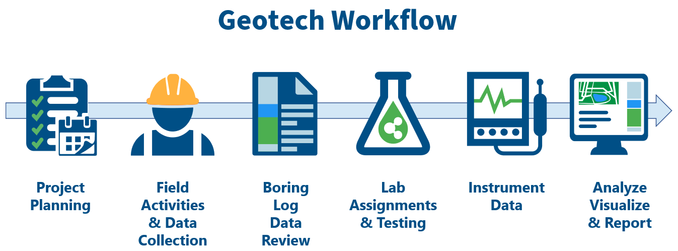
Project Planning and Setup
The EQuIS Geotech workflow begins with project planning. The project planning workflow can be an automated process with the EQuIS REST API integration of an Enterprise Resource Planning (ERP) system or through a standard EQuIS Project Setup utilizing EQuIS Professional.
EQuIS defines the physical (site) or logical (project) extent of data made available for analysis or reporting as a "Facility". Each facility is stored in EQuIS as a FACILITY_ID (auto-generated number) and has an associated FACILITY_CODE (name of facility).
The EQuIS Geotech workflow equates the Project Number to a TASK_CODE and assumes the FACILITY_CODE is equal to the site. Most typical Geotechnical projects will have the TASK_CODE equal the FACILITY_CODE.
Facility = Task = Project
In scenarios where multiple Service Lines are involved in a single site with one client, multiple project numbers associated with the site are expected. Each Project Number will have its own TASK_CODE.
The AT_LOCATION table associates project and tasks.
Note: The EnviroInsite database functions in the Geotechnical Scheme only support one project (TASK_CODE) per facility. |
|---|
Field Activities and Data Collection
EQuIS Geotech supports multiple methodologies for field data collection. Field data can be captured with the EQuIS Collect mobile field app or can be transcribed from paper forms via Enterprise Web Forms on the EQuIS Geotech dashboards. Leveraging EQuIS Collect and Enterprise Web Forms ensures data quality is enforced.
Pre-built Geotechnical Collect templates are provided with EQuIS Geotech to be used in the field on Collect Mobile or to generate Web Forms for data entry. The templates can be used to create web forms pre-populated with data through the Geotechnical Collect Report, such as proposed locations for drilling, Cone Penetration Test (CPT), and/or Dilatometer Test (DMT) activities.
The Web Forms tab on the Field Data Entry dashboard contains a Web Forms widget setup to use the Geotechnical Field Data Entry Collect template designed for manual entry of geotechnical field data. All data mappings, formulas, calculations, and pre-population data used in the Collect template are available in the widget. Once data entry is complete, the data are submitted to EQuIS and undergo rigorous Quality Assurance (QA) checks. Only data successfully passing all Enterprise EDP checks will be uploaded to the database.
Data entered in the Web Forms widget can be temporarily saved and modified until submitted. If data errors exist, data can be corrected in the widget and re-submitted to EQuIS. A status summary of data forms is provided in the Web Forms List on the Web Forms widget as well as on the Data Forms page of the Collect Enterprise dashboard. Furthermore, all edits may be tracked and the original data, final data, error listing, and edit listing are saved to a secure folder for archival and verification.
Log Data Review
At the Log Data Review phase of the workflow, users have a preliminary view into the subsurface site conditions. users are able to utilize maps and grid-based filtering to find and review the necessary soil boring log, CPT log and/or DMT log data. Users can generate draft soil boring logs, well construction diagrams, CPT logs, DMT logs, and subsurface profiles for approval by staff and/or to modify data to reflect observed subsurface conditions.
EQuIS Geotech provides EnviroInsite template files that are used with the EnviroInsite Boring Logs II Report and EnviroInsite Subsurface Profile Report (EarthSoft.Reports.Library.EnviroInsite.dll file) to generate boring logs (soil, CPT, DMT, and well construction) and subsurface profiles of the logs in a PDF format. The EnviroInsite template files can be modified to meet user needs.
The CPT/DMT dashboard can be used to review CPT and DMT information collected during field activities. Users can generate CPT logs in the Boring Log widget configured to use the GeoCPT_EIReport_Template.xml template file with the EnviroInsite Boring Logs II Report output and DMT logs in the Boring Log widget configured to use the GeoCPT_EIReport_Template.xml template file with the EnviroInsite Boring Logs II Report output.
The Boring Logs and Profiles dashboard allows users to easily review and evaluate soil boring information collected during field activities. Users can generate boring logs, well construction diagrams, and subsurface profiles using the EnviroInsite templates.
•Boring Log – Configured to use the EarthSoft_StandardGeoField_BLTemplate.xml template file with the EnviroInsite Boring Logs II Report output for the selected Boring ID(s).
•Well Construction Boring Log – Configured to use the EarthSoft_StandardGeoField_WithWellConstBLTemplate.xml template file with the EnviroInsite Boring Logs II Report output for the selected Boring ID(s).
•Subsurface Profile – Configured to use the EarthSoft_SubsurfaceProfile_Template.xml template file with the EnviroInsite Subsurface Profile Report output for the selected Boring ID(s).
Laboratory Assignments and Testing
Lab Assignments
Based upon the observed field results and project requirements, users may assign laboratory testing to internal or external laboratories. Assignments can be made to a laboratory with a defined analytical methodology associated with the samples, and if needed, allocated to a regional or field office for cost tracking. Fillable lab forms can be supplied to the assigned laboratories to support electronic import of data, or hand entry of laboratory results.
The Lab Assignments dashboard provides for the management and data entry associated with assigning geotechnical laboratory analyses to samples and their associated fees. Users can generate a .zip package that includes a Chain of Custody (COC) and the associated Lab Data Entry Forms for lab tests assigned to the selected sample(s). See the Lab Test Assignment Workflow article for more information.
EQuIS Geotech also allows for the storage of raw laboratory data and reporting calculations directly in the application, reducing the need for external storage and data manipulation. Laboratory data review templates available in EQuIS Geotech include Atterberg limits, grain size, water content, and more.
Lab Data Entry
The Lab Data Entry dashboard provides for the Web Forms data entry and uploading of geotechnical laboratory results associated with samples collected during field activities. The Web Forms tab on the dashboard contains a Web Forms widget setup to use the Geotechnical Field and Lab Data Entry Collect template designed for manual entry of geotechnical laboratory data. The template can be used to create web forms pre-populated with data through the Geotechnical Collect Report, such as sample locations. All data mappings, formulas, calculations, and pre-population data used in the Collect template are available in the widget. Once data entry is complete, the data are submitted to EQuIS and undergo rigorous Quality Assurance (QA) checks. Only data successfully passing all Enterprise EDP checks will be uploaded to the database.
Data entered in the Web Forms widget can be temporarily saved and modified until submitted. If data errors exist, data can be corrected in the widget and re-submitted to EQuIS. A status summary of data forms is provided in the Web Forms List on the Web Forms widget as well as on the Data Forms page of the Collect Enterprise dashboard. Furthermore, all edits may be tracked and the original data, final data, error listing, and edit listing are saved to a secure folder for archival and verification.
Instrument Data
EQuIS Geotech accommodates field and lab instrument data sources as a part of the standard workflow. The EQuIS Geotech dashboards are designed to uploaded instrument data files using EQuIS Link Mapping Project Template files setup as "virtual" formats for the Geotechnical_v2 format (see the Installation and Configuration articles for setup details). Once the Link Mapping Project Template files are appropriately setup as virtual formats, they can be used to upload the instrumentation files to EQuIS via the Enterprise EDP EDD Upload widget.
CPT and DMT Instrument Data
Instrumentation files for a CPT or DMT test can be directly uploaded on the Load CPT/DMT Instrument Files tab on the CPT/DMT dashboard using EQuIS Link Mapping Project Template files setup as "virtual" formats associated with specific CPT and DMT file structures. See the CPT/DMT Instrumentation Workflow article for details on uploading instrumentation files.
Lab Instrument Data
The Lab Instrument Data dashboard supports the uploading, reviewing, and reporting of lab instrument information, specifically Unconfined Compression (UC) and Unconsolidated Undrained (UU) test data. Instrumentation files for a UC or UU test can be directly uploaded on the Load CPT/DMT Instrument Files tab on the Lab Instrument Data dashboard using EQuIS Link Mapping Project Template files setup as "virtual" formats associated with specific UC and UU file structures. See the UC/UU Instrumentation Workflow article for details on uploading lab instrumentation files.
Analyze, Visualize, and Report
The final stage of the EQuIS Geotech workflow is to analyze, visualize, and report on the field and laboratory data that have been collected. EQuIS Geotech includes a multitude of industry standard reports and templates, using ASTM and ASHTO calculations, to aid in producing presentation quality deliverables fit for final reports and distribution.
The Report and Visualization dashboard allows users to easily review, visualize, and report boring information collected during field activities and laboratory results for geotechnical samples. Location filtering allow users to quickly view desired data and logs. Reports can be run and outputs downloaded from the dashboard. Settings on the "Depth Log Page and Visibility Setup" widget control how the boring logs and subsurface profiles will be displayed/output.