|
<< Click to Display Table of Contents >> Navigation: EQuIS Library > Reports > Standard Reports > v54 Reports > Water Levels (Most Recent) |
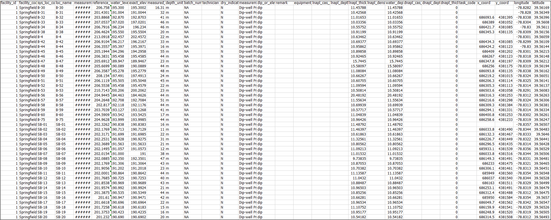
Report Name: Water Levels (Most Recent) (example)
Function: v54.water_levels_recent
Dependencies: N/A
Software: EQuIS Professional and EQuIS Enterprise
Source: EQuIS Standard Schema
Language: English
Output Type: Excel1
Description: The Water Levels (Most Recent) Report uses the Water Levels report to show the most recent water level elevation for each location. This report is ideal for quickly creating groundwater elevation plots using the XYZ chart button.
Installation Instructions: The Water Levels (Most Recent) report is part of the EQuIS Schema and is created when the EQuIS database is created.
Overview:
Additional Related Documentation: Water Level Report Basics
Tables: DT_WATER_LEVEL, DT_WELL, RT_ANALYTE_DETAIL, DT_LOCATION, RT_GROUP, RT_GROUP_MEMBER, VW_LOCATION
Report Parameters * |
||||||||||||||||||||||
|---|---|---|---|---|---|---|---|---|---|---|---|---|---|---|---|---|---|---|---|---|---|---|
|
||||||||||||||||||||||
* This report includes the following hidden parameter(s) that could affect the output of the report: •ebatch •Water level Date Range •Water Level Task(s) •Water level Reported Value •Water level Calculations •significant figures •Water level User Estimated Product Density •Water Level Default Specific Gravity •Water Level Approval Code(s)
If listed, the Additional Fields parameter may be customized as explained in How To Customize the Additional Fields Parameter.
Consult an EQuIS administrator if hidden parameters should be visible or use different default values in a published report (a report that allows saving of user reports). Hidden parameters cannot be viewed or changed in unpublished reports outside of a report parameter file.
|
1Excel report output requires a valid license of Microsoft Excel to view the output.
Copyright © 2026 EarthSoft, Inc. • Modified: 08 Dec 2023