Use the EQuIS for GMS interface, found in the Plus section of the Graphics ribbon in EQuIS Professional, to export EQuIS borehole data to GMS (Groundwater Modeling System) for groundwater simulations, including site characterization, model development, calibration, post-processing, and visualization.
![]()
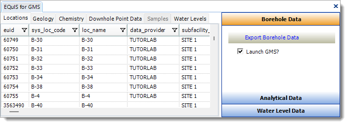
Note: The EQuIS for GMS interface launchs the version of GMS that is associated with *.gpr files in Windows File Explorer, thereby supporting users of GMS 7.0 or later. If no file association exists, the previously used logic still applies when looking for versions 6.5 or older to launch and open the *.gpr file. The paths to the *.bor and *.mat files in the *.gpr were removed to allow for the files to be moved and still open without a "file not found" error in GMS. |
For further assistance, please contact EarthSoft Support.