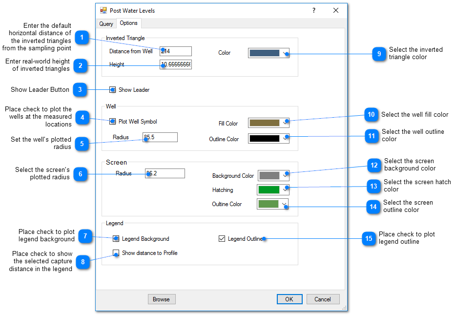
This feature plots the water level data as an upside down triangle at the water level measurement with a leader line to the well's sample or screen on the cross-section profile view. Click Plot > Water Level from the main menu and select Water Level. The Post Water Levels dialog box opens. Modify the water levels properties on the Query tab, Options tab, and EQuIS Query tab as desired. Click the OK button to save changes.
Options Tab