Esri shapefiles can be imported to generate basemap components. The shapefile format is native to the Esri geographical information system (GIS) applications. Each shapefile will contain only one type of graphic primitive.
View a training video on the use of shapefiles in EnviroInsite here.
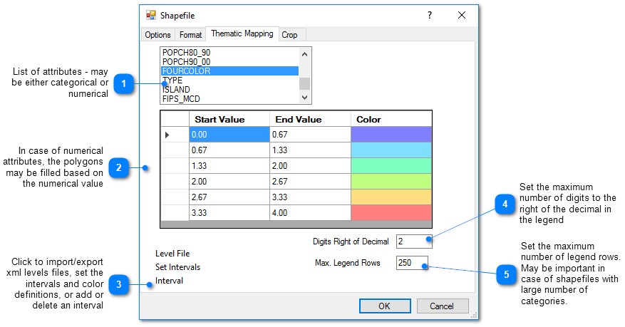
To insert a shapefile map, select Insert> Shapefile from the main menu and select a shapefile from the Shapefile dialog box. The shapefile image is automatically drawn at the correct scale. Once inserted, the default properties of the shapefile object can be edited by double clicking on the shapefile object name in the Plot Control tree. If an EnviroInsite vizx or xml session file is generated after inserting a shape file, the shape file path is included in the session file.
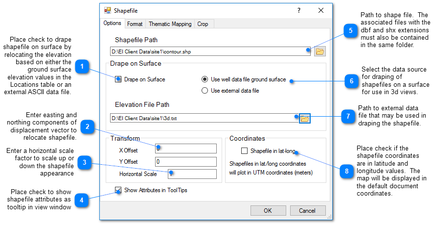
Shapefiles may be draped to the ground surface defined by the ground surface elevation in the well data table by selecting the Drape on Surface check box in the Shapefile dialog box. There are two options for draping a shapefile file on a surface: Use well ground surface or Use external elevation file. If you elect to use well ground surface, EnviroInsite will use the Surface Elevation field of the Wells table to define the surface on which the image is draped. Alternatively, you may use an external elevation file to define the surface. The external elevation file should be an ASCII file, either comma or space delimited. (Do not enter the number of points on the first line of the file.)