|
<< Click to Display Table of Contents >> Navigation: EQuIS Library > Reports > Standard Reports > Water Levels > Water Levels II |
Report Name: Water Levels II (example)
File Name: EarthSoft.Reports.Library.64102.dll
Dependencies: N/A
Software: EQuIS Professional and EQuIS Enterprise
Source: EQuIS Professional install
Language: English
Output Type: Report Grid1
Description: The Water Levels II Report is a class report that generates water level information, improving on the Water Levels function report. The Water Levels II Report conveys information about water levels, depths, and non-aqueous phase liquids (NAPLs) stored in the DT_WATER_LEVEL table. This report uses specific logic for computing the corrected water level elevation based on the input parameters selected. For more information, see Water Level Report Basics and the Water Level Elevation Correction Diagram.
Installation Instructions: This report assembly is part of the EQuIS Professional installation. No additional installation steps are necessary.
Overview:
The Location Name ("LOC_NAME" field) for this report comes from VW_LOCATION. A location is not displayed without a correctly configured record in DT_COORDINATE (where DT_COORDINATE.COORD_TYPE_CODE = DT_FACILITY.COORD_TYPE_CODE and DT_COORDINATE.IDENTIFIER = DT_FACILITY.IDENTIFIER). As a workaround, select DT_LOCATION.LOC_NAME as an "Additional Fields" parameter to display the Location Name from the DT_LOCATION table.
This report contains '@sigfigs' and ‘@decimal_places’ parameters to allow configuration of the number of significant digits or decimal places in the report output. Significant figures is for the water_level column but decimal places will be applied to all of the below columns of report output. They are limited to a maximum of 7 significant digits or decimal places:
•reference_elev •exact_elev •measured_depth_of_well •lnapl_depth •lnapl_thickness |
•lnapl_density •water_depth •water_level_depth •dnapl_depth |
Additional Fields
In Additional Fields for this report, DT_WELL_SEGMENT uses a default SEGMENT_TYPE of SCREEN. An administrator can change this setting in ST_CONFIG with the following entry:
•CONFIG_SECTION = ar
•CONFIG_KEY = SEGMENT_TYPE
•STRING_VALUE = the SEGMENT_TYPE to use, e.g. CASING
Currently, DT_MEASURE_DATUM.MEASURE_DATUM_TYPE cannot be included as an Additional Field in Water Levels II output. This behavior will be addressed in a future build of EQuIS.
Tables: DT_WATER_LEVEL, DT_WELL, RT_ANALYTE_DETAIL, DT_LOCATION, RT_GROUP, RT_GROUP_MEMBER, DT_FACILITY, DT_MEASURE_DATUM, RT_UNIT, RT_UNIT_CONVERSION_FACTOR, VW_LOCATION.
Optional other tables, if Additional Fields are selected:
•DT_WELL
•DT_DRILL_ACTIVITY
•DT_FACILITY
•DT_LOCATION
•DT_MEASURE_DATUM
•DT_TASK
•DT_WATER_LEVEL
•VW_LOCATION
•DT_WELL
•DT_WELL_SEGMENT
Report Parameters * |
||||||||||||||||||||||||||||||||||||||
|---|---|---|---|---|---|---|---|---|---|---|---|---|---|---|---|---|---|---|---|---|---|---|---|---|---|---|---|---|---|---|---|---|---|---|---|---|---|---|
|
||||||||||||||||||||||||||||||||||||||
* Along with the hidden parameters listed for Analytical Results II, the report also includes the following hidden parameters(s) that could affect the output of the report: •Water Level\ Approval Code(s) •User-estimated product density •Default Specific Gravity (default = 0.8) •Extra Selects – advanced parameter to add columns that query report fields, including those selected from Additional Fields
If listed, the Additional Fields parameter may be customized as explained in How To Customize the Additional Fields Parameter.
Consult an EQuIS administrator if hiddden parameters should be visible or use different default values in a published report (a report that allows saving of user reports). Hidden parameters cannot be viewed or changed in unpublished reports outside of a report parameter file.
|
Report Output |
||
|---|---|---|
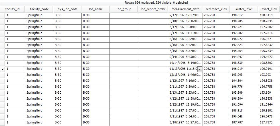
FACILITY_ID FACILITY_CODE SYS_LOC_CODE LOC_NAME LOC_GROUP LOC_REPORT_ORDER MEASUREMENT_DATE REFERENCE_ELEV WATER_LEVEL EXACT_ELEV MEASURED_DEPTH_OF_WELL DEPTH_UNIT |
BATCH_NUMBER TECHNICIAN DRY_INDICATOR_YN MEASUREMENT_METHOD DIP_OR_ELEVATION REMARK EQUIPMENT_CODE LNAPL_CAS_RN LNAPL_DEPTH LNAPL_THICKNESS LNAPL_DENSITY WATER_DEPTH |
WATER_LEVEL_DEPTH DNAPL_CAS_RN DNAPL_DEPTH DNAPL_THICKNESS TASK_CODE APPROVAL_CODE X_COORD Y_COORD LONGITUDE LATITUDE MEASURE_DATUM_TYPE |
1The Report Grid provides additional export options to Excel, Google Earth, Outlook, Shapefile, PDF, Text, Access, XML, or a printer.
Copyright © 2026 EarthSoft, Inc. • Modified: 21 Jan 2026