View Name: VW_LOCATION
View Type: Standard
Language: English
Description: VW_LOCATION combines location, coordinate, facility, geography, and well data from several tables to provide a summary view of location information. VW_LOCATION is used by most reports that contain coordinate data, including Analytical Results II, Action Level Exceedances II reports, Google Earth reports, and many others.
•COORD_TYPE_CODE_LATLONG and IDENTIFIER_LATLONG
Output Columns: All fields are pulled directly from DT_LOCATION unless otherwise noted.
Output Columns |
||
|---|---|---|
EUID FACILITY_ID SYS_LOC_CODE LOC_NAME DATA_PROVIDER SUBFACILITY_CODE LOC_DESC LOC_TYPE LOC_PURPOSE LOC_TYPE_2 LOC_MAJOR_BASIN WITHIN_FACILITY_YN LOC_COUNTY_CODE LOC_DISTRICT_CODE LOC_STATE_CODE LOC_MINOR_BASIN CUSTOM_FIELD_1 CUSTOM_FIELD_2 CUSTOM_FIELD_3 CUSTOM_FIELD_4 CUSTOM_FIELD_5 STREAM_CODE STREAM_MILE PHASE_CODE REMARK_1 REMARK_2 BORE_ID START_DATE END_DATE DRILLING_METHOD |
GEOLOGIST SAMPLING_METHOD DRAWING_CHECKER DRAWING_CHECK_DATE DRAWING_EDITOR DRAWING_EDIT_DATE DRILLER DEPTH_TO_BEDROCK LOG_DATE BEARING PLUNGE APPROVED DRILLING_SUBCONTRACTOR ENGINEER_SUBCONTRACTOR ENGINEER ESTAB_COMPANY_CODE INSPECTOR INSPECT_SUBCONTRACTOR EBATCH MAP_CODE STATUS_FLAG TOTAL_DEPTH (from DT_LOCATION or DT_WELL, selecting the first non-null value) X_COORD (from DT_COORDINATE based on coord_type_code and IDENTIFIER chosen in DT_FACILITY) |
Y_COORD (from DT_COORDINATE based on coord_type_code and IDENTIFIER chosen in DT_FACILITY) UNITS (from DT_COORDINATE.COORD_UNIT) SURF_ELEV (from DT_COORDINATE.ELEV converted to the units in VW_LOCATION.ELEV_UNIT) ELEV_UNIT (from DT_FACILITY.ELEV_UNIT, DT_LOCATION.UNITS or DT_COORDINATE.ELEV_UNIT, selecting the first non-null value from this list) LONGITUDE (from DT_COORDINATE, drawing from data where IDENTIFIER = 'PRIMARY' and the coord_type_code is LIKE '%LAT%LONG%') LATITUDE (from DT_COORDINATE, drawing from data where IDENTIFIER = 'PRIMARY' and the coord_type_code is LIKE '%LAT%LONG%') GEOGRAPHY (from DT_GEOGRAPHY, e.g. 'POINT (-78.9573618607045 35.0005828130316)' - if not available for that SYS_LOC_CODE, populates with 'NULL') WELL_STATUS (from DT_WELL.WELL_STATUS) PARENT_LOC_CODE IDENTIFIER HORZ_DATUM_CODE ELEV_DATUM_CODE COORD_TYPE_CODE (X_COORD, Y_COORD) COORD_TYPE_CODE (COORD_TYPE_CODE_LATLONG) SRID (from RT_COORD_TYPE) HORZ_COLLECT_METHOD_CODE HORZ_ACCURACY_VALUE HORZ_ACCURACY_UNIT ELEV_COLLECT_METHOD_CODE ELEV_ACCURACY_VALUE ELEV_ACCURACY_UNIT |
Tables: DT_LOCATION, DT_FACILITY, DT_COORDINATE, DT_GEOGRAPHY, DT_WELL
Database Type: SQL
Database Schema: Standard (no custom or add-on schemas required)
Database Version: EQuIS 6.0+
Data Requirements: Numeric values in DT_COORDINATE for coordinate values
Output Type: Grid
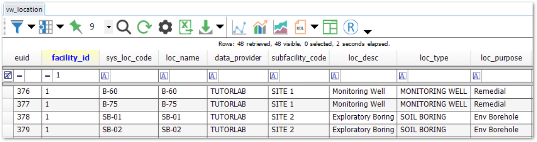
Example Output: View the following example or download the attachment.
Troubleshooting
VW_LOCATION Setup
Empty or missing coordinate data in VW_LOCATION can cause data to be omitted from reports that use VW_LOCATION. Here are common causes of missing VW_LOCATION data:
•Non-numeric coordinate values - use the VW_COORD_NON_NUMERIC view to check for non-numeric values
•DT_COORDINATE.COORD_TYPE_CODE and IDENTIFIER do not match DT_FACILITY.COORD_TYPE_CODE and IDENTIFIER
•If DT_COORDINATE.COORD_TYPE_CODE is LIKE '%LAT%LONG%' but IDENTIFIER does not equal 'PRIMARY'
Change the facility coordinate settings as follows:
1.Log into EQuIS Professional
2.Open DT_FACILITY
3.In the COORD_TYPE_CODE field, change to your desired coordinate type (can be found in RT_COORD_TYPE) associated with your Location_v1 import
4.Change the IDENTIFIER field to PRIMARY
Note: Changes to facility coordinate settings apply for all users of the facility. |
Arithmetic Overflow Error
An "Arithmetic overflow error converting varchar to data type numeric" error when running reports that use VW_LOCATION, or missing data from VW_LOCATION can also be a result of coordinate data with too many digits. Coordinate data in the X_COORD and Y_COORD fields of DT_COORDINATE (visible in VW_LOCATION) can have a maximum of nine digits to the left of the decimal, and a maximum of nine digits to the right of the decimal. Records that do not meet this condition will NOT be returned by VW_COORD_NON_NUMERIC but can be identified by running the following script in SQL Server Management Studio:
SELECT c.facility_id, c.sys_loc_code, c.coord_type_code, c.identifier, c.x_coord, c.y_coord
FROM dbo.dt_coordinate c
WHERE equis.to_number(c.x_coord) IS NOT NULL -- entry is a number
AND equis.to_number(c.y_coord) IS NOT NULL -- entry is a number
AND ( CHARINDEX('.', REPLACE(c.x_coord, '-', '') + '.') > 9 -- too many integer digits in X_COORD
OR CHARINDEX('.', REPLACE(c.y_coord, '-', '') + '.') > 9 -- too many integer digits in Y_COORD
);
DataReader.GetFieldType... Returned Null
For "DataReader.GetFieldType(59) Returned Null" or "DataReader.GetFieldType(2) Returned Null" errors upon opening VW_LOCATION, see the DataReader.GetFieldType(59) Returned Null Error article.
IDENTIFIER
The IDENTIFIER is a facility-specific coordinate IDENTIFIER, for example, PRIMARY. Each facility can have a record in DT_FACILITY to indicate which IDENTIFIER should be considered for mapping facility data (i.e. PRIMARY, SECONDARY, 1, 2, HISTORIC, etc.).
In the DT_COORDINATE table, the IDENTIFIER is used in conjunction with the COORD_TYPE_CODE to indicate unique coordinate systems for each facility. A facility may contain multiple coordinates for each location in DT_LOCATION. For example, a location may have coordinates in LAT LONG and in STATE PLANE. If a location had more than one set of coordinates in LAT LONG, the IDENTIFIER could be used to make these unique. An IDENTIFIER of PRIMARY could be used for the LAT LONG coordinates that were most recently surveyed. An IDENTIFIER of SECONDARY could be used to indicate that alternate LAT LONG values were from another source (i.e. HISTORIC) and not to be used for mapping. The VW_LOCATION Toolbar GUI is used to indicate which COORD_TYPE_CODE and IDENTIFIER is used for third party mapping applications.
COORD_TYPE_CODE_LATLONG and IDENTIFIER_LATLONG
VW_LOCATION returns the LATITUDE and LONGITUDE values based on the lat/long COORD_TYPE_CODE specified for the facility in COORD_TYPE_CODE_LATLONG and IDENTIFYER_LATLONG. This ensures that no duplicate records are included in VW_LOCATION when there are multiple lat/long types.
If the lat/long COORD_TYPE_CODE parameter was not specified for the facility, VW_LOCATION returns the LATITUDE and LONGITUDE values from DT_COORDINATE records that match the pattern of IDENTIFIER='PRIMARY' and COORD_TYPE_CODE like '%LAT%LONG%'. This workflow utilizes aggregation (e.g., MOST RECENT for the matching Identifier) so duplicate records are not returned.
Warning: Some reports that use VW_LOCATION will not work unless COORD_TYPE_CODE_LATLONG and IDENTIFIER_LATLONG are populated in DT_FACILITY. |