Click Plot > 3D Data from the main menu and select Locations. The Locations dialog box opens. Modify the properties of the locations plot on the following tabs as desired:
•Query Tab |
•Format Tab •EQuIS Locations Group Tab |
Where not covered below, location layer options are described on the 2D Locations page.
Click the OK button to save changes.
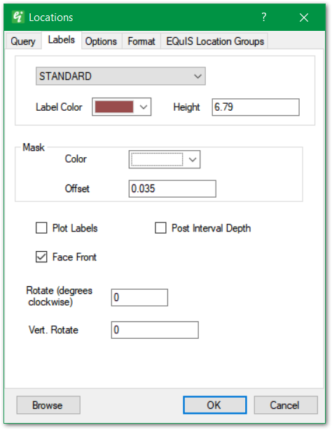
Use the top dropdown to select the Label Text Style. Text styles are defined as document properties.
Label Color – Select the label color.
Height – Enter text height in real-world coordinates.
Mask – The label's background mask is a font outline to enhance the visibility of text strings drawn over busy background images.
Color – Select background mask color.
Offset – Specify the mask width, expressed as a fraction of the specified text height.
Plot Labels – Check to plot Location ID labels.
Rotate – Specify the label rotation in degrees clockwise.
Vert. Rotate – Set the vertical rotation in degrees.
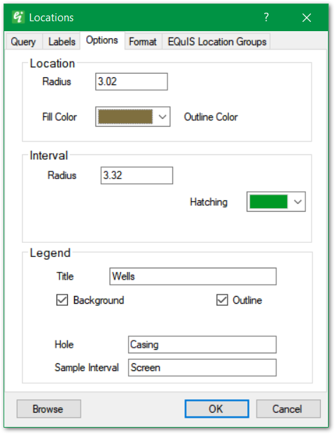
Location Radius – Set location symbol radius in real-world length units.
Location Symbol – Use drop-down in the top right to select the location symbol style.
Location Fill Color and Outline Color – Select the location symbol fill and outline colors.
Interval Radius – Set the draw radius for the interval section.
Interval Hatching – Set the hatching color used in the interval horizon.
Legend Title – Enter legend title.
Legend Background – Check to draw legend background.
Legend Outline – Check to draw legend outline.
Legend Hole and Sample Interval – Set descriptive terms used in legend (only used in 2D and 3D location plots).