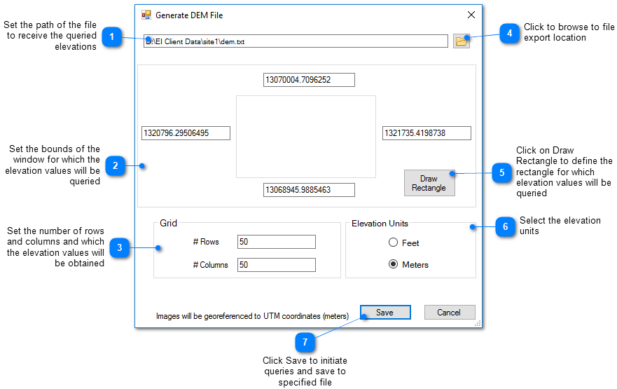
EnviroInsite needs to know the ground surface elevation for a variety of application options. By default, the program uses the measured ground surface elevation at wells or boreholes. Sometimes this is not good enough or there are not enough wells. For those occasions, EnviroInsite has the ability to query online services from the USGS or Natural Resources Canada service and construct its own Digital Elevation Model (DEM) data file:
1.Zoom to the extents you would like your DEM file to use, i.e. first plot your locations or use View > Go To.
2.Select Reports> USGS DEM File or Reports> Canada DEM File from the main menu to access these reports.
3.The DEM .txt file is generated in the set path.
Note: This process may take a long time to complete due to the exchange of data with the online services. After a short period of time (10 to 20 seconds), the estimated number of seconds remaining is displayed at the bottom of this window. |
4.Use the DEM file to plot the surface topography in a 2D Contour, 3D Surface, or the profile layer on a cross-section.
Here is a DEM file for the example Springfield data set.
View a training video on the Digital Elevation Model here.