In the surface feature, measured data values are interpolated using the inverse-distance interpolation method to points evenly distributed along the length of the cross-section. They are then connected and plotted as a surface. This is most often used with water level values to plot a water table or an aquifer's potentiometric surface.
Click Plot> Data from the main menu and select Surface. The Cross-Section Surface dialog box opens. Modify the properties of the surface on the Query tab and Format tab as desired. Click the OK button to save changes.
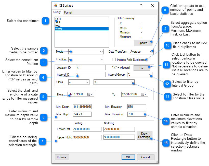
Query Tab
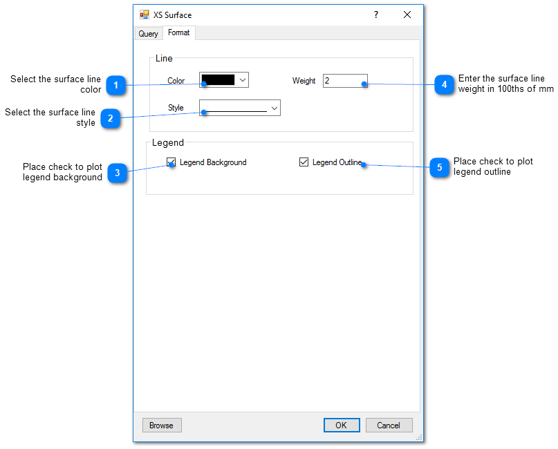
Format Tab