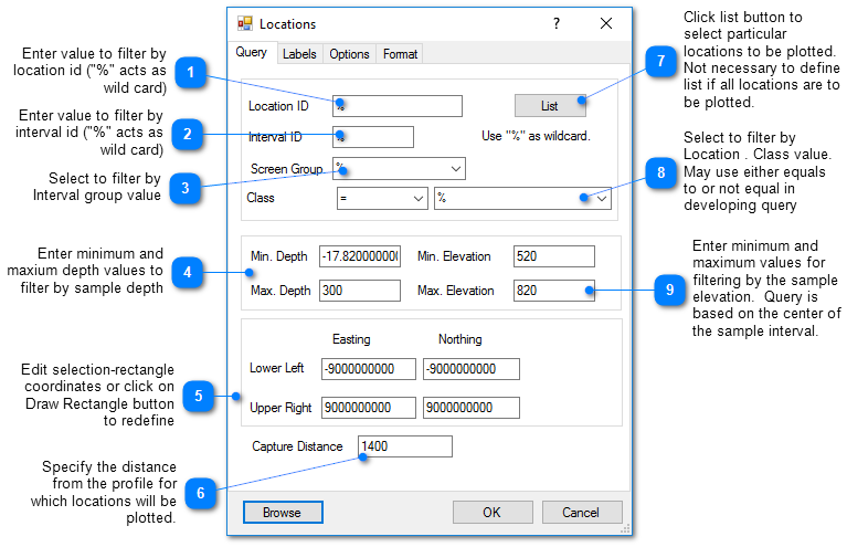
On cross-section maps, wells and screens are plotted at points projected onto the profile from the well location. Data queries can select which wells are plotted on the cross-section profile depending on the specified capture distance, location ID, interval ID, screen elevation, and well depth. EnviroInsite automatically plots a legend and well labels on the cross-section profile. Move both around the screen using a mouse.
Click Plot> Data from the main menu and select Locations. The Locations dialog box opens. Modify the properties of the profile on the Query tab, Labels tab, Options tab, Format tab, and EQuIS Location Groups tab as desired. Click the OK button to save changes.
Query Tab
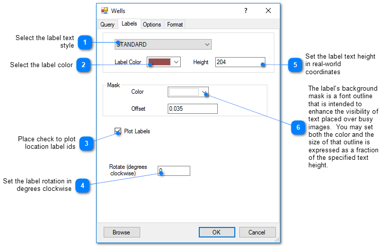
Label Tab
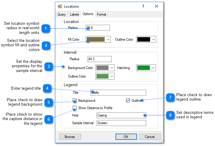
Options Tab