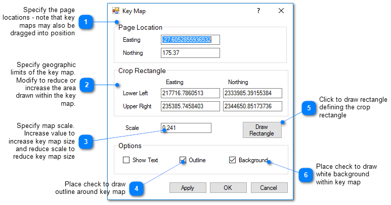
The cross-section key map shows the plan source view where the cross-section was generated along with the trace of the defined polygon used to define the cross-section. The key map may be modified to reduce or increase the displayed portion of the view map. To edit properties of the key map, double click on the key map object in the View window or on the object name in the Plot Control tree. The Key Map dialog box opens. Modify the properties of the key map as desired. Select the Apply button to see changes before saving. Click the OK button to save changes.