This feature is available only for users with data stored in an EQuIS Database.
This water level plot supplements the water level functionality already available in the other downhole plots. In many cases, users will first create the other downhole intervals and then place a water level plot over that interval rectangle. The water level plot is placed on the page by dragging the Water Level entry from the list of Downhole Interval Data fields.
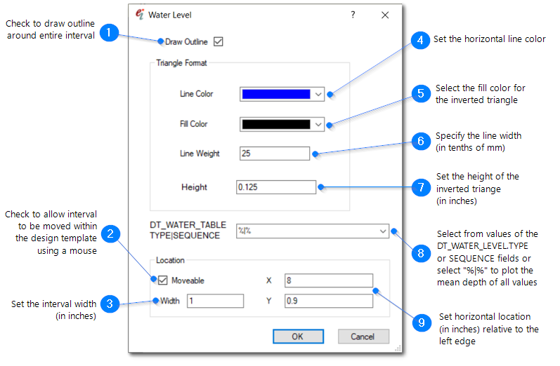
The depth value is calculated based on the contents of DT_WATER_TABLE.DEPTH and DT_WATER_TABLE.DEPTH_UNIT. Users may select which values are plotted by filtering based on values in the DT_WATER_TABLE.TYPE and DT_WATER_TABLE.SEQUENCE FIELD. Multiple instances of this plot may be placed for various combinations of these two fields.