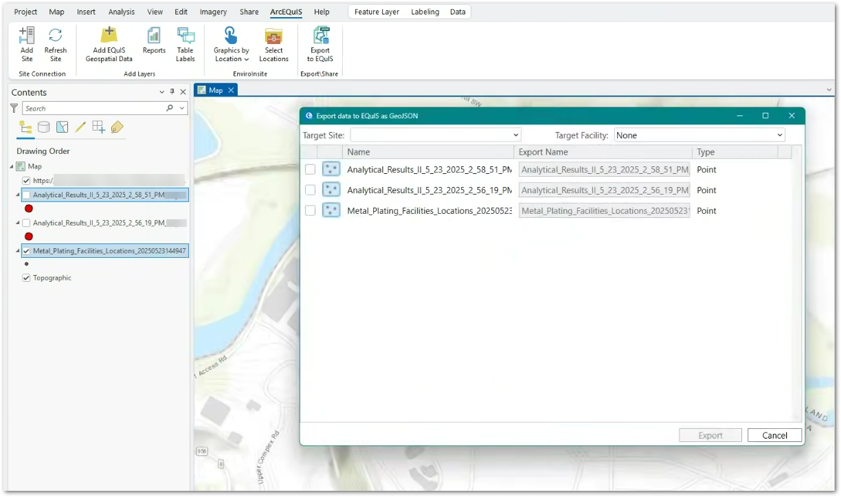
The Export to EQuIS functionality allows users to save features like polygons, points, and polylines to the EQuIS database as a GeoJSON file stored in the DT_FILE table. These feature layers saved as a GeoJSON file can then be displayed as a layer in the Map widget.
Export features from ArcEQuIS by following these steps:
1.Click the Export to EQuIS button in the Export\Share group on the ArcEQuIS ribbon. The "Export data to EQuIS as GeoJSON" window opens with a list of feature layers available in the current ArcGIS Pro map project.
2.Select the Target Site and Target Facility from the respective drop-down lists generated with the sites and facilities available in the current ArcGIS Pro map project.
3.Select the desired feature layer(s). Multiple layers can be selected and exported together.
4.Enter the desired name for the file being exported and click Export. If the GeoJSON file already exists in the DT_FILE table, then the user can overwrite the file, change the file name, or cancel the export.
Example of GeoJSON Layer in Map Widget
After the GeoJSON file has been saved to the DT_FILE table, the user can add the GeoJSON file to the Map Widget as a GeoJSON layer.

