EnviroInsite does allow for the display of MrSID images. The code that processes those images is facilitated by public-domain libraries provided by Celartem, Inc. dba LizardTech. Since MrSID files are routinely greater than one gigabyte, EnviroInsite extracts a user-specified portion of the MrSID image to process to user specifications and writes out an image file in a common format specified by the user. That file is automatically georeferenced and inserted in the EnviroInsite view.
View a training video on importing MrSID images here.
To insert a MrSID image, select Insert> Image from the main menu and select the image file from the browser. When a MrSID image is selected, the FormMrSID dialog box opens.
Options Tab
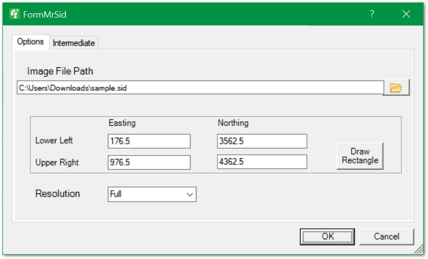
Image File Path – MrSID file path. Click Browse button to browse to the MrSID file.
Coordinates (Lower Left/Upper Right & Easting/Northing) – Coordinates of rectangular area to be drawn to the view. May be modified by editing these values or clicking the Draw Rectangle button.
Draw Rectangle – Click Draw Rectangle to redefine the bounds of the portion of the image to be represented in the view.
Resolution – Select from Full, Half, Quarter, or Eighth resolution for downsampling from the image's original resolution.
Intermediate Tab
This dialog box allows for modification of the properties of the intermediate file created for insertion in EnviroInsite.
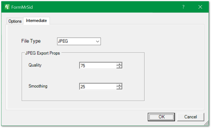
File Type – Select from JPEG, TIFF, BMP, or PNG as the output file type for the downscaled image that is inserted in the view.
JPEQ Export Props > Quality – Select the JPEG export Quality in percent.
JPEQ Export Props > Smoothing – Specify the smoothing factor in percent. Smoothing can reduce JPEG compression artifacts that occur by specification of lower quality images.