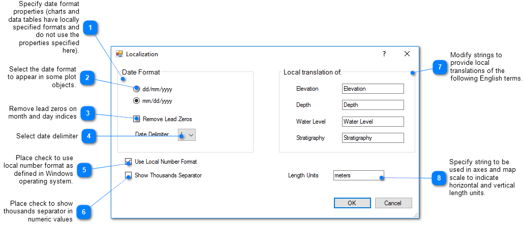
The Localization properties provide translations of common terms as well as date and numeric formats. All coordinates must be in a single set of units. The length units label is a text string that displays on the plot axes and map scales. These properties are stored in the EnviroInsite document file and thus restored each time the document is loaded. Select Edit> Localization from the main menu to access the Localization dialog box to set these properties.
Note: When connected to an EQuIS database, the Length Units are specified in EQuIS and therefore this option is not available. |