Coordinates are configured on the Document tab of the View Options dialog, which is accessed by selecting View > Options from the main menu. For display in UTM (Universal Transverse Mercator), State Plane, or MTM (Modified Transverse Mercator) system projections, users may need to specify the particular zone that identifies the global-scale location. The coordinate system (but not the zone numbers) may also be selected using the coordinate system drop-down menu in the zoom toolbar. The State Plane Zone is for the United States only.
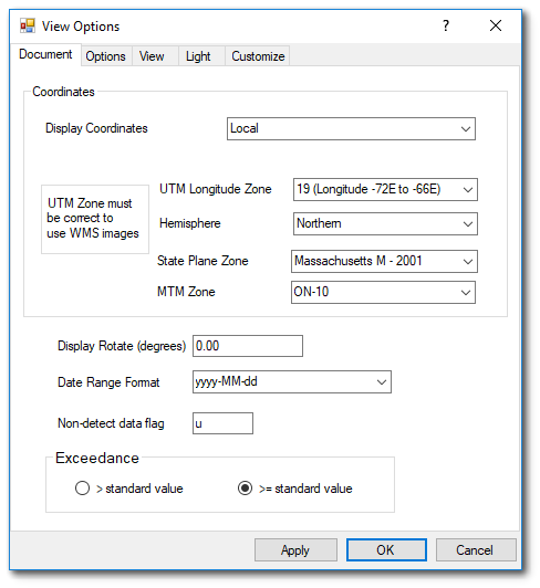
EnviroInsite does not convert coordinates between projections. Therefore, if for example, the location coordinates are in UTM, then displaying the locations in a State Plane coordinate system is not possible. If the original (database) coordinates are in a projected coordinate system, such as UTM, State Plane, OSGB, or spherical Mercator, then the EnviroInsite display coordinates should be set to the same coordinate system. The coordinate system must be set properly for the correct display of CAD files, locations specified in latitude-longitude coordinates, and online maps from WMS services, Azure Maps, or ArcGIS Online.
Select the coordinate projection prior to connecting to a database. EnviroInsite will recall the last used projection from a prior session and set that as the default.
If the location coordinates are in latitude-longitude, check the “Coordinates specified as latitude – longitude” box in the database connection setup window. EnviroInsite will have already placed a check in that control if you have populated RT_COORDINATE_TYPE.SRID with a value of 4326 or if the DT_FACILITY.COORD_TYPE_CODE begins with “LAT”. EnviroInsite will automatically select the appropriate UTM, MTM, or State Plane Zone based on the longitude and latitude limits.
To change the projection after connecting to a database, it is advisable to first close the project or document (File> Close), then select the coordinate system, and finally connect to the database and facility.