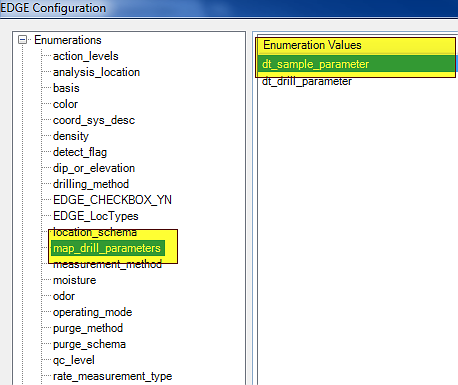
Before collecting lithology data, see this document on mapping Drill Parameters Values in EDGE. EDGE also comes with a configuration format and soil description example for the lithology wizard under the EDGE\Configuration Formats folder. For more information on the lithology wizard in EDGE, see the above-mentioned document. Please note that by default, EDGE stores drill parameters in DT_DRILL_PARAMETER. To save in DT_SAMPLE_PARAMETER, use the configuration tool to move DT_SAMPLE_PARAMETER up in the list.
1.Click the Drill Activity tab and fill in the required information, including the DRILL_START_DATE.
2.Add additional information to Drill Activity.
3.Click the Lithology Field tab.
4.Select a task from the task chooser, and a location from the location chooser. Click "Add" on the tab menu bar.
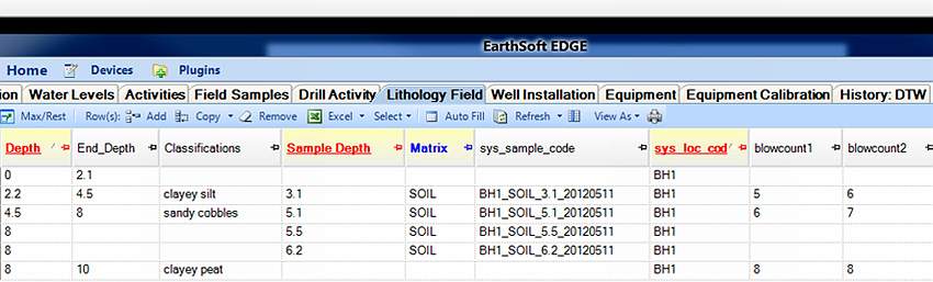
5.Enter Lithology data: location, depth, END_DEPTH, classifications, and drilling parameters.
6.Add sample depth if samples are taken from the same depth as the layer start depth.
7.Add more rows to add extra samples collected at various depths.
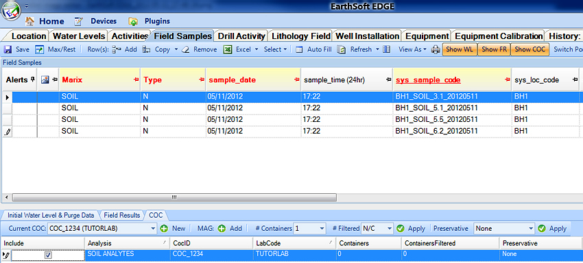
8.Samples are now automatically created in the Field Samples Tab.
9.Create the COC and assign analysis to the samples from either the COC manager or the COC tab in Field Samples.